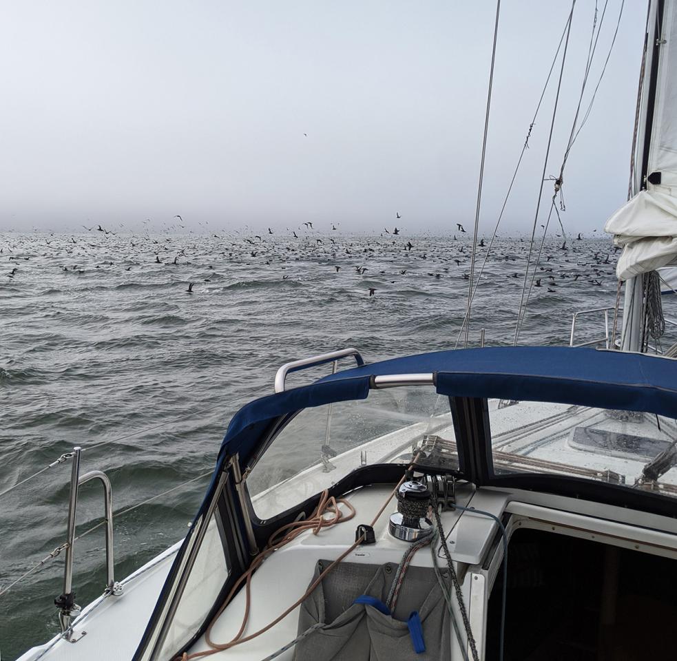
The infamous San Francisco Bay fog, affectionately known as "Karl The Fog" by locals, can catch anyone off guard, making this article a must-read for every Modern Sailor. Your first few times finding your way back to the Modern Sailing marina in the fog or dark can feel uncomfortable or intimidating. There's no need for fear! Prepare to navigate in low visibility by following this informative guide.
(NOTE: MSC charterers must have completed ASA 104, Bareboat Cruising or the Night Sailing Clinic at Modern Sailing to be certified to sail or motor after dark.)
Before You Head Out in Low Visibility Conditions
If you haven’t already, download a navigation app such as Navionics, available on the App Store and Google Play. There are also several other navigation apps available that are worth giving a try. Before the day of your charter, spend some time familiarizing yourself with the app and learn how to plot courses and record your track. Also download an AIS app to help monitor shipping traffic.
If you plan to use a navigation app, be sure that your mobile device is fully charged and that you have a charging cable and 12v USB adapter or a battery pack with you.
If you’d prefer not to rely on electronics, break out a San Francisco Bay chart before your sail and familiarize yourself with the buoys and channel markers, their locations, light sequences and sounds.
Every MSC charter boat is supplied with a Bay chart (usually located in the navigation table), but we also recommend that you keep a copy of your own that you can study at home. Water-resistant charts can be purchased from local marine supply stores and a variety of online vendors. It’s also recommended to keep a copy of NOAA Chart No. 1 in your sailing gear bag as a reference for chart symbol meanings.
While you’re sailing in clear conditions, keep an eye out for buoys and markers and make a mental note of their location in relation to nearby land features. Also encourage your crew to look for them and call them out by name or number when spotted.
Technology-Assisted Navigation
In thick fog when visibility is reduced to less than 50 feet, it can be difficult to spot buoys and land features, rendering line-of-sight navigation difficult or impossible. Bear in mind that technology provides sailors with additional navigation tools, but is not a complete substitute for the eyes and ears and other traditional navigation methods.
In low-visibility conditions, much as in daylight navigation, there are various techniques to establish a fix. Try using a combination of electronic and physical means to navigate to the nearest aid to navigation (ATON) such as a buoy or channel marker. When the ATON comes in sight, you have verification that your electronic tools are taking you where you intend to go.
A handheld GPS device can help you determine your location and pinpoint your position on the Bay chart. The compass apps on iPhones and Androids also provide GPS coordinates.
However, the simplest and most effective way to find your way back to base is to use a chart plotter or a navigation app such as Navionics to plot your course (where you’re going) before you depart and/or plot your track (where you’ve been) as you go. Radar can also help detect land features and fixed and moving obstacles. Do not attempt to use radar to assist your navigation if you lack training or experience in its use.
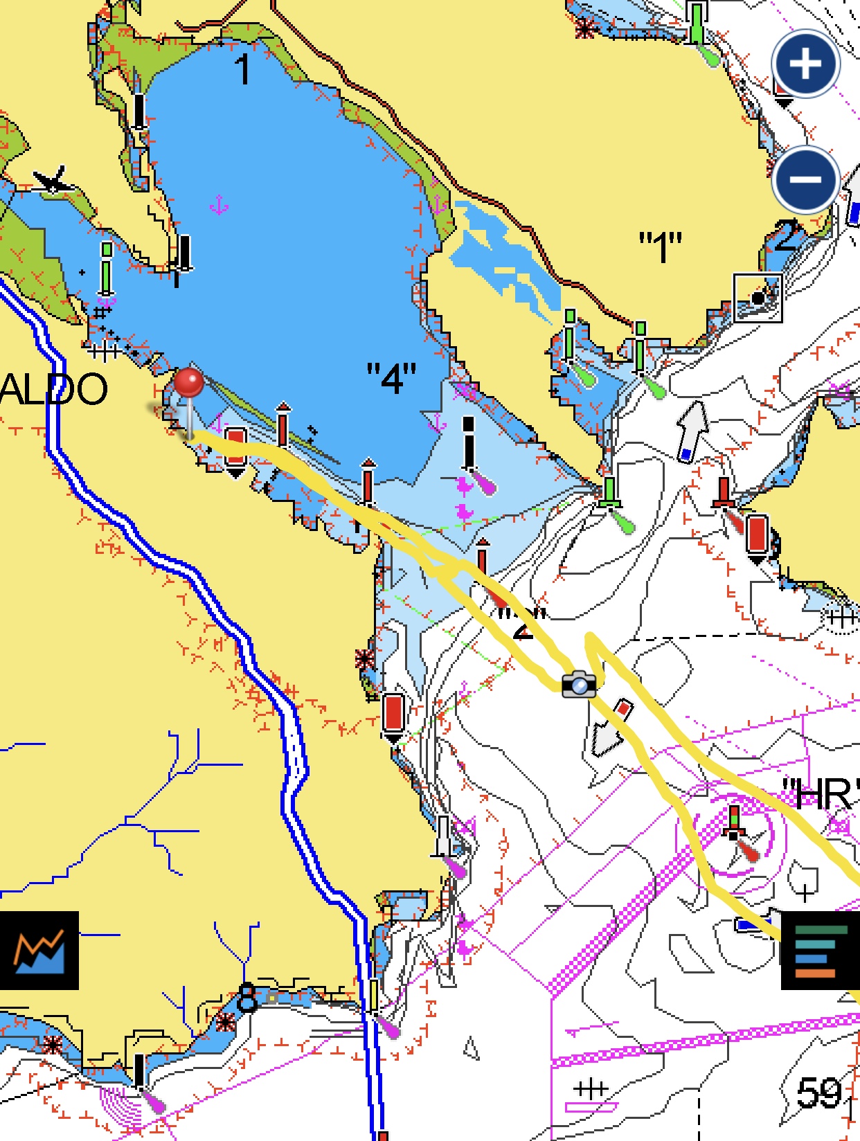
A navigation app like Navionics makes it possible to follow the exact track you took when leaving base. In the screenshot below, the recorded track to and from MSC base is depicted as a yellow line. Your vessel will appear on-screen as a pointed triangle or other boat-shaped symbol that moves along the chart as you go.
Many MSC yachts are equipped with chart plotters and/or radar. In the Gold Fleet, Wimm, Auriah, Andiamo, and Traharta carry them. Andiamo also has radar. All Platinum Fleet vessels and the catamaran Kanaloa are equipped with chart plotters. Also, all Platinum vessels except Liberty have radar. Kanaloa includes radar with AIS overlay for even more navigation ease and confidence.
While at the dock, spend some time familiarizing yourself with how to plot a course and/or record your track. If you’re unfamiliar with using a chart plotter or radar, our Electronic Piloting and Radar Clinic will provide you the skills you need to increase your confidence, decrease the amount of time it will take for you to learn differing navigation systems, and use the radar effectively.
Know Your San Francisco Bay ATONS, Their Light Sequences, Sounds, and Coordinates
When visibility is reduced, you’ll need to rely more on your hearing. Turn off the music soundtrack or radio station and lower the volume of your VHF radio so that approaching vessels, audible buoys and horns can be heard. Encourage your crew to also keep their ears open.
The following aids to navigation in the Bay emit audible tones in addition to flashing lights. (Coordinates are given for the ATONS in the water.)
- Southampton Shoal Lighted Marker (East Bay) - Iso R 6s 32ft 6M BELL Lat. 7.88198 Long. -37.88198
- Blossom Rock Buoy (roughly ½ nautical mile north-northeast of the northeast tip of San Francisco) – GR “BR” Fl (2+1) G 6s BELL Lat. 37.81833 Long. -122.40333
- Point Blunt Lighted Beacon (the southeastern tip of Angel Island) – Fl GR 60ft 13M 5s HORN (Nearby is the soundless lighted buoy #3 just off Point Blunt – GR “3” Fl G 1s Lat. 37.85033 Long. -122.4175.)
- Alcatraz Island Buoy (located just west of the northern tip of Alcatraz) – GR “AZ” Fl (2+1) G 6s BELL Lat. 37.82667 Long. -122.42167
- Golden Gate Bridge South Tower Beacon – Fl R 15s 50ft Priv HORNS (Learn more about the Golden Gate Bridge Foghorns & Beacons on the Golden Gate Bridge Highway & Transportation District’s website.)
Decoding Chart ATON Abbreviations
- Iso = periods of dark and light flashes are of equal duration (Iso R 6s = a red light that is lit for 6 seconds and dark for 6 seconds)
- R = red, G = green, GR = green/red, RG = red/green, WR = white/red, RW=red/white
- "BR" - "AZ" - "HR" - Blossom Rock, Alcatraz, and Harding Rock (two capitalized letters between quotes represent the abbreviated name of the ATON, while a number between quotes indicates its number, i.e. "1" or "3")
- Fl = flashing light
- G or R (following Fl) indicates the color of the flashing light
- 6s = 1 flash every 6 seconds (a number followed by the lowercase letter "s" denotes the number of seconds between flashes or series of flashes)
- 6s (2 + 1) = 2 flashes, a pause, then 1 flash, occuring every 6 seconds (if you see a solitary number in parentheses, this represents the number of flashes in a series following the length of time between the series)
- 50ft or 60ft = #ft indicates the height of the beacon above the water
- 13M = visible from 13 miles away (a number followed by a capitalized "M" indicates the number of miles from which the ATON can be seen in clear conditions)
- Priv = an ATON not maintained by the USCG
- Ra Ref = radar reflector
- RACON = radar beacon easily seen on radar
Location of Marks in SF Bay by L-30.com provides a handy reference of all in-water ATON coordinates in the Bay.
Know The Hazards Around You
As previously mentioned, keep your eyes and ears open for approaching vessels and ships. An AIS app can be very helpful, but do not rely on AIS alone, as some vessels may not be equipped with an AIS transmitter.
Learn more about shipping traffic patterns and AIS apps in our Member Resources article Steer Clear of SF Bay Shipping Traffic.
BONUS - Navigating to the Sausalito Charter Base from the Central Bay
Directions begin from the red and green Harding Rock Buoy (RG "HR" Fl (2+1) R 6s RACON) in the Central Bay, which tends to be the fog's favorite hang-out.
1) From Harding Rock, head 310o (magnetic) north-northwest to Green Buoy #1 (G “1” Fl G 4s) for approximately half a nautical mile. If it’s foggy and you hear the Golden Gate Bridge foghorns to your port side, you are headed in the correct direction. Adjust your course higher or lower to compensate for tidal currents if needed. Also, be aware that your boat's compass may show some deviation from the magnetic direction due to large metallic objects aboard (such as the engine). While you're in the Central Bay, be aware that you will be in or near the Deep Water Shipping Lane, so keep your eyes and ears open for shipping traffic. Monitoring shipping traffic communications on VHF channel radio 14 can be very helpful.
2) From Green Buoy #1, head 315o and proceed for approximately 1 nautical mile to the Sausalito Channel Marker/Light #2 (Fl R 4s 14ft 3M “2”). At night, you will be able to spot the very bright lights on the bottom edge of the Spinnaker Restaurant by the time you reach marker #2, possibly even sooner.
Once you reach channel marker #2, you are within the boundaries of Richardson Bay and in the Sausalito Channel. If conditions permit, this is a good time to send a crew member take watch on the bow (with a flashlight if it's dark) to keep an eye out for ATONs, mooring balls, boats anchored and under way, and other hazards. If there’s enough visibility, you will be able to spot channel markers #4 and #6 ahead. Watch for their lights flashing red every 6 seconds.
Do your best to remain in the channel and look out for small dinghies being rowed or motored. Also, many of the boats in Richardson Bay do not have anchor lights. Some areas of the anchorage are very shallow, so be sure to line yourself up in the channel using these markers as your guide.
3) Proceed along the Sausalito waterfront towards Sausalito Channel Marker/Light #4 (Fl R 4s 15ft 4M “4” Ra Ref) and then to Sausalito Channel Light #6 (Fl R 4s 15ft 4M “6” Ra Ref). Near #6, you will see a large white vintage sloop anchored at a “fork in the road.” Steer left before the vintage sloop to travel alongside the waterfront. When you see the magnificent Matthew Turner tall ship and/or the Army Corp of Engineers dock, you’re close to home.
4) As you approach the Modern Sailing harbor, you will soon spot our catamarans docked on the outer side-ties of the marina. Your crew member on the bow should be using the flashlight to keep a sharp eye out for the mooring balls to your starboard side. In the winter, the catamarans are sometimes tied to the mooring balls just outside the marina.
Do you want to learn more about chart navigation, chart plotters, radar, and night sailing? There are no prerequisites to take ASA 105, Coastal Navigation. If you’re ASA 104, Bareboat Cruising or Platinum Fleet certified, our Electronic Piloting and Radar and Night Sailing Clinics provide hands-on training to give you all the skills and confidence you need to navigate in any visibility conditions.
Questions? Email or call our friendly office at (415) 331-8250.
Article by Mary Elkins on December 17, 2020
Special thanks to Jim Haussener for his contributions to this article.